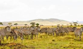
In which countries are the sites that most contribute to global biodiversity persistence located and how well are these sites covered by protected areas in each country? Safeguarding the Key Biodiversity Areas (KBAs) is vital for halting the decline in biodiversity and for ensuring the long term and sustainable use ofterrestrial and marine natural resources. The establishment of protected areas in the locations where these KBAs are found is one of the priority actions to safeguard their conservation values.
RIS Feed
Indicator
Protection Levels of Key Biodiversity Areas (KBAs) by country
23530
Indicator
Protected Areas Connectivity (ProtConn)
How well connected are the terrestrial protected area systems at the country level? This indicator can be used to assess the degree to which the spatial arrangement of Protected Areas (PAs) is successful in ensuring connectivity of protected lands; to monitor the country progress towards Aichi Target 11 of the Convention on Biological Diversity (CBD) and design where additional efforts are most needed in expanding or reinforcing the connectivity of PA systems.
23517
Indicator
Total carbon
Indicator unit: Amount of carbon stored in the soil (0 to 30 cm depth), expressed in Mg (megagrams or tonnes) per km2 .
Area of interest The SOCI has been calculated at the country level and for all protected areas and is provided and for each country, each terrestrial ecoregion and each terrestrial and coastal protected area of size ≥ 1 km2.
Policy question: There are two main policy questions to which the SOCI indicator is relevant:
23548
Indicator
Above ground carbon
Indicator unit: The above-ground carbon (AGC) is expressed in Mg (megagrams or tonnes) of carbon per km2 . It corresponds to the carbon fraction of the oven-dry weight of the woody parts (stem, bark, branches and twigs) of all living trees, excluding stump and roots, as estimated by the GlobBiomass project (globbiomass.org) with 2017 as the reference year.
23428
Indicator
Soil organic carbon
Indicator unit: Amount of carbon stored in the soil (0 to 30 cm depth), expressed in Mg (megagrams or tonnes) per km2.
Area of interest: The SOCI has been calculated at the country level, terrestrial ecoregion level and for all protected areas and is provided for each country and each terrestrial and coastal protected area of size ≥ 1 km2.
23535
Indicator
Below ground carbon

Indicator unit: The belowground biomass carbon (BBC) is expressed in Mg (megagrams or tonnes) of carbon per km2 . It represents an estimation of the carbon stored in the roots of all living trees. This carbon pool is calculated as a fraction of the aboveground biomass carbon stock using root-to-shoot ratios (R). It is derived from two main data sources: the global aboveground biomass map produced by the GlobBiomass project (globbiomass.org) and the 2019 Refinement to the 2006 IPCC Guidelines for National Greenhouse Gas Inventories (IPCC, 2019).
23449
Indicator
Inland surface water dynamics

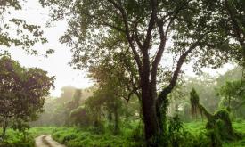
How well are we protecting freshwater ecosystems and how strong are anthropogenic changes affecting surface water in a given area? Human pressures are constantly increasing and it is important to monitor the consequences of the associated changes on the environment, in particular inside and around protected areas, to ensure that natural ecosystems and their associated species and ecosystem functions (e.g. goods and services) are preserved.
23460
Indicator
Land Fragmentation
Indicator units: Natural (and semi-natural) land fragmentation refers to the reduction of area, the emergence of discontinuities and the isolation of natural land patches within a region of interest. Natural land spatial pattern is a relevant measure to capture changes in size, shape and structural connectivity, in particular the breaking down of large patches of natural land into smaller patches, the presence of linear features and isolated small fragments.
23472
Indicator
Land Degradation
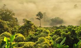
Humans need increasing amounts of plant biomass for producing food, fodder, fiber and energy. Being able to meet these demands in the long term requires a sustainable use of land and vegetation resources. A persistent reduction in biomass production or land productivity will directly and indirectly impact almost all terrestrial ecosystem services and benefits that form the basis for sustainable livelihoods of all human communities.
23466
Indicator
What is the conservation status of the fish stocks?
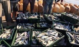
A fundamental requirement for productive fisheries is maintenance of the biodiversity that offers natural systems resilience against changing conditions.(FAO, State of World Fishery and Aquaculture 2020). Threatened marine fish species can be legally caught in industrial fisheries and moreover according to FAO, annual estimate of fisheries interactions with at least 20 million individuals of endangered, threatened and/or protected species. Here we show the catch records (tonnes) of globally threatened species in the EEZ by country in the last 10 years.
---
23421